

Beautiful uncancelled certificate from the Rand McNally & Company issued in 1997. This historic document was printed by United States Banknote Company and has an ornate border around it with a vignette of a globe and clouds. This item has the signatures of the Company's President, Andrew McNally IV. 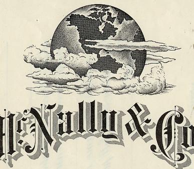
Certificate Vignette Rand McNally & Company is the preeminent American publisher of maps, atlases, and globes for travel, reference, commercial, and educational uses. It also provides online consumer street maps and directions, as well as commercial transportation routing software and mileage data. The company is headquartered in the Chicago suburb of Skokie, Illinois with additional offices in Irvine, California and Markham, Ontario and a distribution center in Richmond, Kentucky. In 1856, William Rand opened a printing shop in Chicago and two years later hired a newly-arrived Irish immigrant, Andrew McNally, to work in his shop. The shop did big business with the forerunner of the Chicago Tribune, and in 1859 Rand and McNally were hired to run the Tribune's entire printing operation. In 1868, the two men formally established Rand McNally & Co. and bought out the Tribune's printing business. The company initially focused on printing tickets and timetables for Chicago's booming railroad industry, and the following year supplemented that business by publishing complete railroad guides. In 1870, the company expanded into printing business directories and an illustrated newspaper, the People's Weekly. According to company lore, during the Great Chicago Fire in 1871, Rand McNally quickly had two of the company's printing machines buried in a sandy beach of Lake Michigan, and the company was up and running again only a few days later. Title page of the 1879 Business Atlas, from DavidRumsey.comThe very first Rand McNally map, created using a new cost-saving wax engraving method, appeared in the December 1872 edition of its Railroad Guide. Rand McNally became an incorporated business in 1873, with Rand as its president and McNally as vice president. The Business Atlas, containing maps and data pertinent to business planning, was first published in 1876. The atlas is still updated today, now titled the Commercial Atlas & Marketing Guide. The Trade Book department was established in 1877, publishing such titles as The Locust Plague in the United States. Rand McNally began publishing educational maps in 1880 with its first line of maps, globes, and geography textbooks, soon followed by a world atlas. The company began publishing general literature in 1884 with its first title, The Secret of Success, and the Textbook department was established in 1894 with The Rand McNally Primary School Geography. Also in 1894, the company opened an office in New York City headed by Caleb S. Hammond, who later started his own map company. By 1899, the company employed nearly 700 people. William Rand retired and sold his interest to the other company officers. Andrew McNally assumed the role of president until his death in 1904. Rand died the following year. Andrew's son, Frederick McNally, became president of the company upon his father's death, just as the age of the automobile was beginning. Rand McNally's first road map, the New Automobile Road Map of New York City & Vicinity, was published in 1904. When Frederick McNally died in 1907, his sister's husband, Henry Beach Clow, became president. In 1910, the company acquired the line of Photo-Auto Guides from G.S. Chapin, which provided photographs of routes and intersections with directions. Andrew McNally II (son of Frederick McNally) personally took photos on his honeymoon for the Chicago-to-Milwaukee edition. The company continued to expand its book publishing business, with best-selling children's books such as The Real Mother Goose (1916) and Kon-Tiki (1950). Rand McNally was the first major map publisher to embrace a system of numbered highways. One of its cartographers, John Brink, invented a system that was first published in 1917 on a map of Peoria, Illinois. In addition to creating maps with numbered roads, Rand McNally also erected many of the actual roadside highway signs. This system was subsequently adopted by state and federal highway authorities. The oil industry quickly developed an interest in road maps, enticing Americans to explore and consume more gasoline. In 1920, Rand McNally began publishing road maps for the Gulf Oil Company, to be freely distributed at its service stations. By 1930, Rand McNally had two major road map competitors, General Drafting and Gousha, the latter of which was founded by a former Rand McNally sales representative. The Rand McNally Auto Chum, later to become the ubiquitous Rand McNally Road Atlas, was first published in 1924. The first full-color edition was published in 1960. It became fully digitized in 1993. The Goode's School Atlas, named for its first editor, Dr. J. Paul Goode, was published in 1922. It became a standard text for high school and college geography curricula. Later retitled Goode's World Atlas, it is now in its 21st edition. Andrew McNally II took over as president in 1933. He and his heirs, Andrew McNally III and IV, successively served as president until 1993. The first Rand McNally Travel Store was opened in New York City in 1937. In the 1990s it was turned into a chain with 29 locations, but by 2005 all had been closed as a cost-saving measure. Rand McNally moved its headquarters from Chicago to suburban Skokie, Illinois in 1952. The company opened its Versailles, Kentucky, book publishing plant in 1962 with 300,000 square feet and 23 employees. In 1994, the plant was the first to implement a new Kodak computer-to-plate printing system.[1] When the plant was sold in 1997, it was over 1,000,000 square feet and employed 1,255 people. Cover of 1969 Rand McNally road atlasIn 1963, because the company was not satisfied with the ability of existing map projections to create intuitive depictions of the entire world, they commissioned Dr. Arthur H. Robinson to develop what became known as the Robinson projection, which became very popular and was used extensively for constructing maps of the entire world. Rand McNally acquired Transportation Data Management in 1980, which brought Rand's mapping expertise with TDM's software-based transportation products. Rand McNally began creating maps digitally in 1982. In 1984, the company acquired the assets of the Denoyer-Geppert Company, a leading school map and globe publisher. In 1988, Rand acquired Champion Map and its facilities in Daytona Beach, Florida, which was later closed in 2001. On 18 April 1996, the 82 employees of the H. M. Gousha Company, one of Rand McNally's longtime rivals, found their Comfort, Texas, building locked up with a note taped to the door stating that the company had been purchased by Rand McNally and all their jobs had been eliminated. In 1989, Rand McNally donated its extensive collection of its maps to the Newberry Library. Now in possession of Gousha's archives as well, Rand McNally donated that map archive to the Newberry in late 2002. Rand McNally acquired Allmaps Canada in 1993, subsequently becoming a wholly-owned subsidiary company, Rand McNally Canada. With a string of acquisitions and growth throughout the 1980s and 1990s, Rand McNally employed over 4,000 people in four business groups. The company had been majority-owned by the McNally family since 1899, but by 1997 the family had decided to divest its interest in the company. In January 1997, the company announced it was selling its Book Services Group, which employed 1,700 people in Versailles, Kentucky and Taunton, Massachusetts, to World Color Press for $155 million. In February 1997, the DocuSystems Group was sold to Code Hennessy & Simmons, a Chicago-based private equity firm. In April 1997, the Media Services Group, which employed 350 people with offices in Nashville, Tennessee; Fremont, California; Shannon, Ireland; and the Asia-Pacific region, was sold to McQueen, a Scottish software company. The sole remaining group, publishing, represented the core geographic businesses of the company. In November 1997, the McNally family completed its divestiture by selling its majority ownership to AEA Investors for a reported $500 million. Much of the purchase price was "leveraged," meaning that the company took on a significant debt load hedging on future earnings. On 29 March 1999, Rand McNally finalized its acquisition of Thomas Bros. Maps, the prominent Southern California mapmaker best known for its ubiquitous Thomas Guide.[12] While company name "Thomas Bros. Maps" is no longer used, Rand McNally continues to brand its products as "The Thomas Guide" in select markets, primarily in the western U.S. On 4 May 1999, Rand McNally purchased King of the Road, a regional map publisher and distributor based in the Pacific Northwest, which had a previous partnership with Thomas Bros. King of the Road titles are no longer available. AEA's stake in the company was acquired by Leonard Green & Partners through a prepackaged Chapter 11 restructuring deal on 15 January 2003.[11] Rand McNally emerged from bankruptcy less than 60 days later, shedding more than $250 million in debt. History from Wikipedia and OldCompanyResearch.com (old stock certificate research service).
Certificate Vignette


 - Delaware 1932")